Publications
BODOQUE: An Energy-Efficient Flow Monitoring System for Ephemeral Streams.
In this paper, we introduce BODOQUE, a hardware-software infrastructure to monitor water flows in ephemeral streams where the water rarely flows with great force. BODOQUE uses a low-power TinyML-based camera to detect the presence of water, activating a more complex system to measure flow only when the water flows, thereby optimizing energy consumption. This paper focuses on the power-saving capabilities of BODOQUE, comparing the energy consumption of different edge devices run- ning the code that measures water flow in the streams. Our goal is to determine the optimal hardware setup for the system based on our experiments, which involve performance and energy con- sumption tests. The results provide valuable information for future environmental monitoring systems, considering the best balance among the device’s cost, performance, and energy consumption.
In Situ and Crowd-Sensing Techniques for Monitoring Flows in Ephemeral Streams.
In this article, we introduce an in situ and Mobile crowdsourcing (MCS) monitoring system for efficient real-time flow measurement in ephemeral streams. Our system is deployed in the Mar Menor watershed (Murcia, SE Spain), the first ecosystem in Europe with a legal entity, promoted by the citizens in the face of the environmental crisis that is besetting it.

Urban river management by innovative monitoring.
This chapter presents a general outlook of innovative monitoring of rivers. Special attention is given to river flow monitoring through remote sensing images. Because of the relatively low costs and high possible spatiotemporal resolutions, the treated topics are mainly centered on the use of Unmanned Aerial Systems. The chapter comprises six main sections, covering river monitoring systems and flood risk management as well as a particularly prepared section illustrating four different case studies in urban areas. The chapter also provides operational information on platforms, sensors, and existing software besides case studies to illustrate how to apply this novel technology at operational and scientific levels.
Intelligent multispectral vision system for non-contact water quality monitoring for wastewater.
Water quality monitoring in sewer networks remains a technical challenge even though water pollution and control are high priorities since decades. Current water quality monitoring usually analyzes samples in laboratories, allowing only sporadic measurements, or uses immersed sensors in the wastewater, leading to clogging and sensor fouling resulting in expense due to intensive maintenance. Both techniques thus have serious limitations. Previous research showed that UV-Vis reflectance spectrometry can be used for non-contact monitoring of turbidity (TUR) and Chemical Oxygen Demand (COD), which are two key water quality indicators. Although spectrometer achieve high spectral resolution their limited spatial field of view is problematic for highly inhomogeneous surfaces as is the case wastewater In this study, we obtain beyond state-of-art measurement accuracies by combining machine learning techniques with increased spatial field-of-view Multi-Spectral Imaging (MSI) whilst substantially reducing the spectral resolution. We designed and built a dedicated setup with a monochromatic camera and an active illumination of thirteen LEDs covering the spectrum range of 200-700 nm.
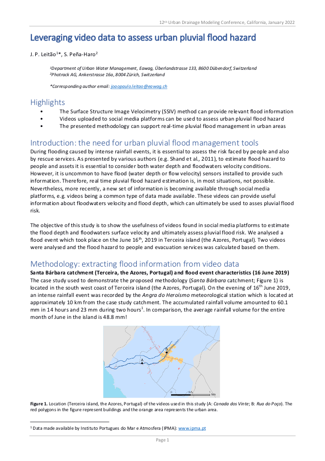
Leveraging video data to assess urban pluvial flood hazard.
The objective of this study was to show the usefulness of videos found in social media platforms to estimate the flood depth and floodwaters surface velocity and ultimately assess pluvial flood risk. We analysed a flood event which took place on the June 16th, 2019 in Terceira island (the Azores, Portugal). Two videos were analysed and the flood hazard to people and evacuation services was calculated based on them.
Robust Image-Based Streamflow Measurements for Real-Time Continuous Monitoring.
The volumetric flow rate in rivers is essential to analyze hydrological processes and at the same time it is one of the most difficult variables to measure. Image based discharge measurements possess several advantages, one of them being that the sensor (camera) is not in contact with the water, it can be placed safe of floods, its mounting position is very flexible and there is no need of expensive structures/constructions. During the last years several image-based methods for measuring the surface velocity in rivers and canals have been proposed and successfully tested under different conditions. However, these methods have been used and configured to perform well under the particular conditions of a single recording or single site. The objective of this paper is to present a system which has reached a Technology Readiness Level (TRL) 9. The system is able to measure the volumetric flow under different conditions day and night and all year long, the system is able to perform in rivers or canals of different sizes and flow velocities and under different conditions of visibility. In addition, the system is capable of measuring the river stage optically without the need of a stage, but it can also integrate external level sensor. Important for a wide set of customers, the system must be able to interface with the various common signal input and output standards, such as 4–20 mAmp, modbus, SDI-12, ZRXP, and even with customer specific formats. Additionally, the developed technology can be implemented as an edge or as a cloud system. The cloud system only needs a camera with Internet connection to send videos to the cloud where they are processed, while the edge systems have a processing unit installed at the site where the processing is done. This paper presents the key aspects needed to move from prototype with TRL5-7 and lower toward the presented field proven system with a TRL 9.
Image-based flow measurements in wide rivers using a multi-view approach.
A multi-view image based system has been developed to measure the discharge in large rivers using Surface Structure Image Velocimetry. In large rivers the image resolution might not be enough to allow for a proper characterization of the flow surface patterns. To get more detailed surface patterns, a Pan-Tilt-Zoom camera was used, which has the capability to move and zoom into smaller areas of the river on the spannwise direction. The system has been installed in the Zollbrücke on the Rhine river where it is around 100 meters wide during low flow conditions. The system records videos with a duration of 5 seconds in each one of the views every 5 minutes. One month of data was compared against the reference values. The mean discharge during that period was of 190 m 3 /s and the Root Mean Square Error was found to be 8.4 m 3 /s compared to the official values.
Image-based flow monitoring in a remote alpine catchment.
This paper presents an image-processing based method for measuring water level and volumetric flow rate for a stream located in an alpine catchment. The system is energetically self-sufficient and consists of an IP camera, a floodlight beamer, a processing and a transmission units. It can be accessed in real-time for monitoring the stream. The water level is detected automatically and several thresholds for water level or discharge warning can be implemented. The surface velocity field is measured by means of Surface Structure Image Velocimetry. Using the measured water level and velocity as an input, the flow rate can be computed using a physical model. A rating curve is continuously generated with the measured water level and discharge, thus allowing de-rating detection after extreme events.
A comparison of tools and techniques for stabilising unmanned aerial system (UAS) imagery for surface flow observations.
While the availability and affordability of unmanned aerial systems (UASs) has led to the rapid development of remote sensing applications in hydrology and hydrometry, uncertainties related to such measurements must be quantified and mitigated. The physical instability of the UAS platform inevitably induces motion in the acquired videos and can have a significant impact on the accuracy of camera-based measurements, such as velocimetry. A common practice in data preprocessing is compensation of platform-induced motion by means of digital image stabilisation (DIS) methods, which use the visual information from the captured videos in the form of static features to first estimate and then compensate for such motion. Most existing stabilisation approaches rely either on customised tools developed in-house, based on different algorithms, or on general purpose commercial software. Intercomparison of different stabilisation tools for UAS remote sensing purposes that could serve as a basis for selecting a particular tool in given conditions has not been found in the literature. In this paper, we have attempted to summarise and describe several freely available DIS tools applicable to UAS velocimetry. A total of seven tools six aimed specifically at velocimetry and one general purpose software were investigated in terms of their (1) stabilisation accuracy in various conditions, (2) robustness, (3) computational complexity, and (4) user experience, using three case study videos with different flight and ground conditions. In an attempt to adequately quantify the accuracy of the stabilisation using different tools, we have also presented a comparison metric based on root mean squared differences (RMSDs) of inter-frame pixel intensities for selected static features. The most apparent differences between the investigated tools have been found with regards to the method for identifying static features in videos, i.e. manual selection of features or automatic. State-of-the-art methods which rely on automatic selection of features require fewer user-provided parameters and are able to select a significantly higher number of potentially static features (by several orders of magnitude) when compared to the methods which require manual identification of such features. This allows the former to achieve a higher stabilisation accuracy, but manual feature selection methods have demonstrated lower computational complexity and better robustness in complex field conditions. While this paper does not intend to identify the optimal stabilisation tool for UAS-based velocimetry purposes, it does aim to shed light on details of implementation, which can help engineers and researchers choose the tool suitable for their needs and specific field conditions. Additionally, the RMSD comparison metric presented in this paper can be used in order to measure the velocity estimation uncertainty induced by UAS motion.
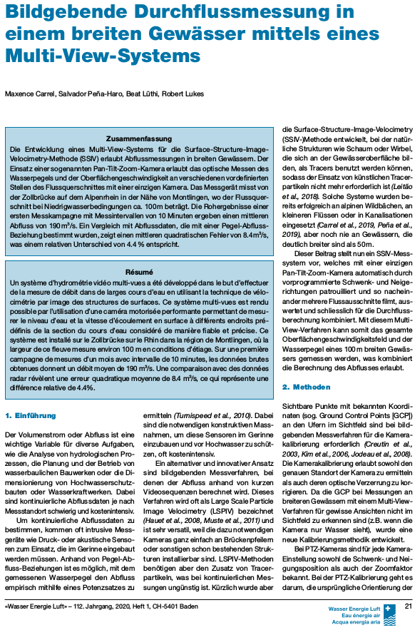
Bildgebende Durchflussmessung in einem breiten Gewässer mittels eines Multi-View-Systems.
Die Entwicklung eines Multi-View-Systems für die Surface-Structure-Image-Velocimetry-Methode (SSIV) erlaubt Abflussmessungen in breiten Gewässern. Der Einsatz einer sogenannten Pan-Tilt-Zoom-Kamera erlaubt das optische Messen des Wasserpegels und der Oberflächengeschwindigkeit an verschiedenen vordefinierten Stellen des Flussquerschnittes mit einer einzigen Kamera. Das Messgerät misst von der Zollbrücke auf dem Alpenrhein in der Nähe von Montlingen, wo der Flussquer schnitt bei Niedrigwasserbedingungen ca. 100 m beträgt. Die Rohergebnisse einer ersten Messkampagne mit Messintervallen von 10 Minuten ergeben einen mittleren Abfluss von 190 m3/s. Ein Vergleich mit Abflussdaten, die mit einer Pegel-Abfluss-Beziehung bestimmt wurden, zeigt einen mittleren quadratischen Fehler von 8.4 m3/s, was einem relativen Unterschied von 4.4 %entspricht.
Towards harmonisation of image velocimetry techniques for river surface velocity observations.
Since the turn of the 21st century, image-based velocimetry techniques have become an increasingly popular approach for determining open-channel flow in a range of hydrological settings across Europe and beyond. Simultaneously, a range of large-scale image velocimetry algorithms have been developed that are equipped with differing image pre-processing and analytical capabilities. Yet in operational hydrometry, these techniques are utilised by few competent authorities. Therefore, imagery collected for image velocimetry analysis (along with reference data) is required both to enable inter-comparisons between these differing approaches and to test their overall efficacy. Through benchmarking exercises, it will be possible to assess which approaches are best suited for a range of fluvial settings, and to focus future software developments. Here we collate and describe datasets acquired from seven countries across Europe and North America, consisting of videos that have been subjected to a range of pre-processing and image velocimetry analyses. Reference data are available for 12 of the 13 case studies presented, enabling these data to be used for reference and accuracy assessment.
An Evaluation of Image Velocimetry Techniques under Low Flow Conditions and High Seeding Densities Using Unmanned Aerial Systems.
Image velocimetry has proven to be a promising technique for monitoring river flows using remotely operated platforms such as Unmanned Aerial Systems (UAS). However, the application of various image velocimetry algorithms has not been extensively assessed. Therefore, a sensitivity analysis has been conducted on five different image velocimetry algorithms including Large Scale Particle Image Velocimetry (LSPIV), Large-Scale Particle Tracking Velocimetry (LSPTV), Kanade–Lucas Tomasi Image Velocimetry (KLT-IV or KLT), Optical Tracking Velocimetry (OTV) and Surface Structure Image Velocimetry (SSIV), during low river flow conditions (average surface velocities of 0.12–0.14 ms-1 , Q60) on the River Kolubara, Central Serbia. A DJI Phantom 4 Pro UAS was used to collect two 30-second videos of the surface flow. Artificial seeding material was distributed homogeneously across the rivers surface, to enhance the conditions for image velocimetry techniques. The sensitivity analysis was performed on comparable parameters between the different algorithms, including the particle identification area parameters (such as Interrogation Area (LSPIV, LSPTV and SSIV), Block Size (KLT-IV) and Trajectory Length (OTV)) and the feature extraction rate. Results highlighted that KLT and SSIV were sensitive to changing the feature extraction rate; however, changing the particle identification area did not affect the surface velocity results significantly. OTV and LSPTV, on the other hand, highlighted that changing the particle identification area presented higher variability in the results, while changing the feature extraction rate did not affect the surface velocity outputs. LSPIV proved to be sensitive to changing both the feature extraction rate and the particle identification area. This analysis has led to the conclusions that for surface velocities of approximately 0.12 ms-1 image velocimetry techniques can provide results comparable to traditional techniques such as ADCPs. However, LSPIV, LSPTV and OTV require additional effort for calibration and selecting the appropriate parameters when compared to KLT-IV and SSIV. Despite the varying levels of sensitivity of each algorithm to changing parameters, all configuration image velocimetry algorithms provided results that were within 0.05 ms-1 of the ADCP measurements, on average.
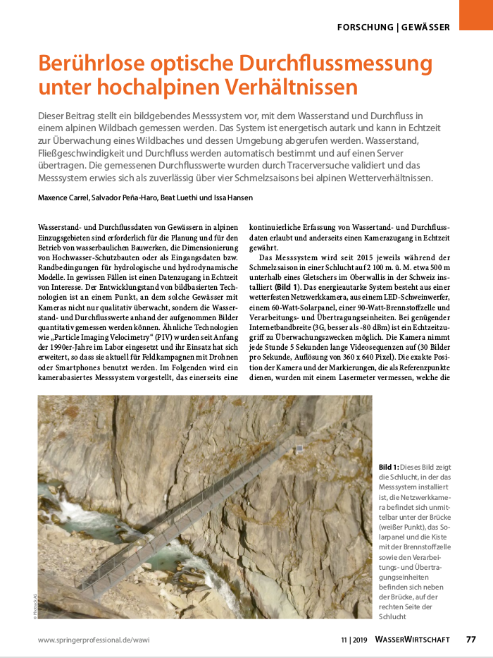
Berührlose optische Durchflussmessung unter hochalpinen Verhältnissen.
Dieser Beitrag stellt ein bildgebendes Messsystem vor, mit dem Wasserstand und Durchfluss in einem alpinen Wildbach gemessen werden. Das System ist energetisch autark und kann in Echtzeit zur Überwachung eines Wildbaches und dessen Umgebung abgerufen werden. Wasserstand, Fließgeschwindigkeit und Durchfluss werden automatisch bestimmt und auf einen Server übertragen. Die gemessenen Durchflusswerte wurden durch Tracerversuche validiert und das Messsystem erwies sich als zuverlässig über vier Schmelzsaisons bei alpinen Wetterverhältnissen.
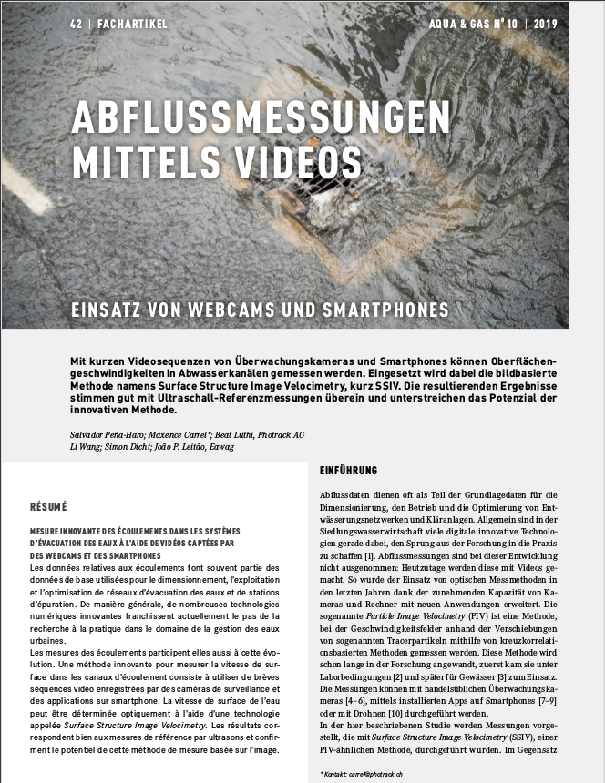
Abflussmessungen Mittels Videos.
Mit kurzen Videosequenzen von Überwachungskameras und Smartphones können Oberflächengeschwindigkeiten in Abwasserkanälen gemessen werden. Eingesetzt wird dabei die bildbasierte Methode namens Surface Structure Image Velocimetry, kurz SSIV. Die resultierenden Ergebnissestimmen gut mit Ultraschall-Referenzmessungen überein und unterstreichen das Potenzial der innovativen Methode.
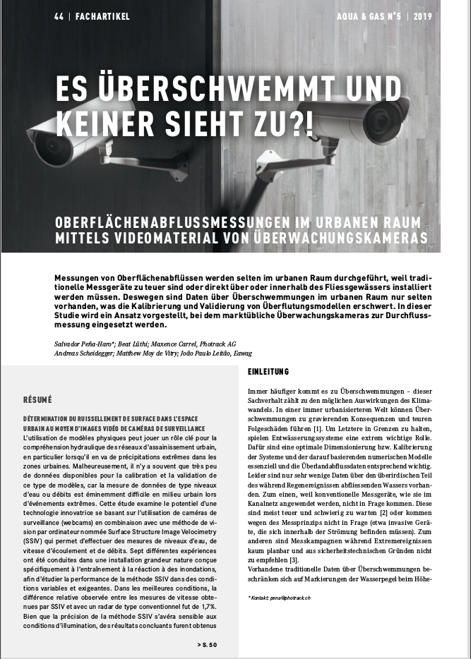
Oberflächenabflussmessungen im Urbanen raum mittels Videomaterial von Überwachungskameras.
Messungen von Oberflächenabflüssen werden selten im urbanen Raum durchgeführt, weil traditionelle Messgeräte zu teuer sind oder direkt über oder innerhalb des Fliessgewässers installiert werden müssen. Deswegen sind Daten über Überschwemmungen im urbanen Raum nur selten vorhanden, was die Kalibrierung und Validierung von Überflutungsmodellen erschwert. In dieser Studie wird ein Ansatz vorgestellt, bei dem marktübliche Überwachungskameras zur Durchfluss messung eingesetzt werden.
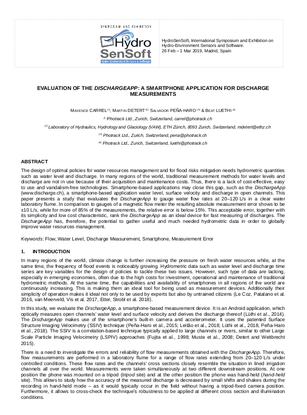
Evaluation of the DischargeApp: a smartphone application for discharge measurements.
Herein we present a study that evaluates the DischargeApp to gauge water flow rates at 20–120 L/s in a clear water laboratory flume. In comparison to gauges of a magnetic flow meter the resulting absolute measurement error shows to be ±10 L/s, while for more of 85% of the measurements, the relative error is below 15%. This acceptable error, together with its simplicity and low cost characteristic, rank the DischargeApp as an ideal device for fast measuring of discharges. The DischargeApp has, therefore, the potential to gather useful and much needed hydrometric data in order to globally improve water resources management.
Urban overland runoff velocity measurement with consumer-grade surveillance cameras and surface structure image velocimetry.
Here we investigated the potential of using surveillance camera footage to measure surface flow velocity thanks to the Surface Structure Image Velocimetry (SSIV). Seven real-scale experiments conducted in a specialized flood training facility were used to test the SSIV method under varied and challenging conditions. In the best conditions tested, SSIV and conventional flow sensors differed by only 1.7% (0.1% standard deviation). While the method proved sensitive to light conditions, our results suggest that infrared lighting could be used to increase measurement consistency. Our study concludes that for measuring overland flow velocity in urban areas, surveillance and traffic cameras can be used.
Mobile device app for small open-channel flow measurement.
We present a mobile device app to measure discharge in open channels. With this tool flow data can be collected reliably and cheaply. The technology, on which the app is based, is derived from an already implemented and tested similar webcam application. The methodology has been tested for the webcam application in a pilot project in Switzerland. The results show that it is capable to produce continuous and reliable data for water level, surface velocity and runoff. The accuracy is within 5% of data obtained from a commercial radar sensor. The existing preliminary results for the smartphone application indicate similar accuracy. The tool has the potential to become the state of the art method for mobile runoff measurements, as it is truly high-tech and low-cost.